The 11 Best Adventure Travel Apps You Need
The Best Adventure Travel Apps – A Curated Guide for Backpackers, Hikers, and Remote Travelers
When you’re planning a trip that involves a tent, a stove, and places without road signs, the right phone apps can save you hours of frustration. The wrong ones just drain your battery. This guide covers the best adventure travel apps for planning, navigation, safety, and gear management. I’ve tested these in deserts, mountains, and jungles, and I’m only recommending the ones that actually work. This list is built on real-world use, not sponsored hype. I do use affiliate links here to support the site, but they only point to products I’d buy myself.

How to Choose Adventure Travel Apps (and What to Avoid)
Before you start downloading, understand what makes an app useful for adventure travel. First, offline capability is non-negotiable. If an app can’t function without a signal, delete it. Second, battery efficiency matters—apps that constantly ping your GPS or pull data will kill your phone halfway through a long day. Third, consider storage size. You don’t want an app that eats up a gigabyte of space on a phone that’s already carrying a whole country’s worth of offline maps.
A common mistake is downloading too many apps. You end up with clutter, duplicated features, and a phone that slows down. I’ve been there. Another mistake is relying solely on a single app without a non-digital backup. A paper map and compass weigh nothing and don’t run out of battery. Also, watch out for data-hungry apps that require an account or constant syncing—they’re not built for remote areas. Use this framework to cut the noise before you read the rest of this guide.
1. Maps.Me – Best Offline Navigation for Remote Areas
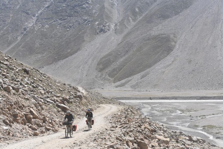
For sheer reliability and ease of use, Maps.Me is the top choice for offline navigation. It uses OpenStreetMap data, which is surprisingly detailed for trails, dirt paths, and even small springs in the backcountry. I’ve used it to navigate dirt roads in Central Asia and hiking routes in the Caucasus without any signal.
What makes it great:
- Full offline maps for entire countries (download before you leave)
- Search functionality works offline—find campsites, peaks, and water sources
- Bookmark feature for marking your campsite or a hidden viewpoint
Practical tips: Download the entire country or region you’re visiting on Wi-Fi before you go. Use bookmarks to mark potential campsites or water refill points. The app also lets you measure distances, which is useful for estimating hiking times.
Tradeoffs: The map data can be less accurate in very dense jungles or extremely remote areas because it relies on user contributions. There’s no real-time traffic, but you don’t need that on a trail. It works best for trekkers, overlanders, and anyone who needs a reliable offline GPS.
2. AllTrails – Best for Finding and Evaluating Hiking Routes
AllTrails is the go-to for discovering trails you didn’t know existed. The search filters are strong: you can sort by difficulty, length, elevation gain, and activity type (hiking, trail running, mountain biking). The real value comes from the user reviews. People will tell you if a trail is overgrown, if the water crossing is deep, or if the parking lot is full by 7 AM.
Use case: I check recent reviews before a long drive to a trailhead to make sure the trail is open and well-maintained. This has saved me multiple times from wasted days.
The free version gives you plenty for discovery. The Pro version adds offline maps, which is useful if you’re in a spot without signal, but the free version covers most day hikes.
Tradeoff: The trail data is user-submitted, so accuracy on elevation and distance can vary. It’s best for hikers, trail runners, and day-hikers. For multi-day backcountry navigation, you’ll want something more robust.
3. Gaia GPS – Best for Advanced Backcountry Navigation
Gaia GPS is for when Maps.Me or AllTrails feel too basic. It offers detailed topo maps, slope shading, and a variety of map layers. You can overlay public land boundaries, NOAA weather radar, and even wildfire data. This makes it the standard for multi-day treks, mountaineering, and route planning in technical terrain.

Why it’s better than free options:
- NOAA weather overlays give you real-time forecasts even in remote areas
- Public land boundaries help you know where you can legally camp
- Offline maps are reliable and detailed
Tradeoff: It has a steeper learning curve. The interface isn’t as intuitive as AllTrails or Maps.Me. It’s also subscription-based, so you’re paying $20–$40 per year depending on the tier. For experienced hikers, climbers, and thru-hikers who plan routes months in advance, it’s worth the cost.
4. PackPoint – Best for Packing Logistics and Gear Lists
Packing is a constant pain point for adventure travelers. You either forget something essential or bring your entire gear closet. PackPoint solves this by generating a packing list based on your destination, the weather forecast, and your planned activities (hiking, camping, city touring).
How it works: You input where you’re going and for how long. The app pulls weather data and creates a list. You can then manually add your own gear, like a tent, stove, or specific layers. It syncs with other apps, so you can share lists with travel partners.
Tradeoff: The free version has limited customization. The Pro version lets you save custom gear lists, which is useful if you have a specific setup. It’s best for anyone who travels with a consistent gear kit but always second-guesses themselves.
Think about pairing this with some solid packing cubes or a reliable backpack. Travelers who need to keep gear organized may want to consider packing cubes on Amazon.
5. Komoot – Best for Route Planning (Biking & Hiking)
Komoot focuses on turn-by-turn voice navigation for cycling and hiking. You plan a route by choosing a starting point and a destination, then the app suggests routes based on surface type (paved, gravel, single track), difficulty, and highlights (viewpoints, ruins, water sources).
How it compares to AllTrails: AllTrails is better for finding an existing trail. Komoot is better for creating your own route. The community-generated ‘highlight’ points are useful—people will mark a cool rock formation or a hidden swimming hole.
Best for: Bikepackers, mountain bikers, and multi-day hikers who want to design a custom itinerary. The offline maps work well worldwide.
6. Emergency & Safety Apps: What Works When You Have No Signal
In true wilderness, phone apps have limits. But there are tools that work off-grid, and understanding the difference between them is critical.
Type 1: Satellite messengers (require hardware)
Apps like the Garmin inReach or SPOT require a dedicated satellite device. The Garmin Explorer series and the inReach Mini 2 let you send SOS signals and two-way text messages from anywhere. This is the gold standard for remote travel. If you’re going where there’s zero cell coverage for days, this is not optional.
Type 2: Smartphone apps with off-grid features
What3Words is a location-sharing tool that divides the world into 3-meter squares, each with a unique three-word address. You can share this with a contact before you lose signal, and it works offline if you pre-download the grid. It’s not a substitute for a PLB (personal locator beacon), but it’s useful for sharing a precise location.
Another smart move: download an offline first aid guide. The Red Cross has a free app with offline content. Do this before you leave, because when you need it, you won’t have signal.
The key tradeoff: Free apps like What3Words are no replacement for a satellite messenger. In truly remote areas, invest in a dedicated device. For those heading into the backcountry, check the Garmin inReach Mini 2 on Amazon is worth considering.

7. XE Currency – Best for Managing Money Abroad
This is a simple, reliable tool that keeps you from getting ripped off at currency exchanges. XE Currency lets you download live exchange rates for offline use. It updates automatically when you have signal, and you can set rate alerts for specific currencies.

Why it matters: You can convert any amount in seconds. When a taxi driver or hotel clerk gives you a quote, you know exactly what it’s worth in your home currency. It saves you from overpaying and keeps your travel costs predictable.
Best for: Any international traveler. It’s free, lightweight, and works in airplane mode once you’ve downloaded the data.
8. Skyscanner – Best for Booking Flights on a Flexible Schedule
Skyscanner is a staple for budget-conscious travelers. Its ‘Everywhere’ search is the key feature. You can enter your home city and a date, and it shows you the cheapest destinations worldwide. This is perfect for open-ended travelers who aren’t locked into a specific destination.
What else works: Set price alerts for specific routes. Use the multi-city booking option if you’re doing a point-to-point itinerary. It’s also useful for finding one-way flights, which is common in adventure travel.
Tradeoff: Occasionally, it lists fares that are out of date or from small airlines with hidden fees. Always book directly with the airline after you find the deal.
9. Three Apps I Tried and Eventually Deleted (And What I Use Instead)
Honesty builds trust, so here are three apps that didn’t work for me, and what I replaced them with.
TripIt – This trip planner organizes all your itineraries into one timeline. On paper, it sounds great. In practice, it’s cluttered and overwhelming for adventure travel. It’s designed for business trips with multiple flights and hotel bookings. For a muddy week in the mountains, it’s overkill. I just use a simple notes app and my calendar.
A generic hiking app (name withheld) – This app claimed to have offline trail maps for hundreds of regions. It crashed twice within an hour. The maps were low resolution, and the download process was slow. I deleted it and stuck with Maps.Me.
A language translator app – I downloaded one that promised offline translation, but it worked poorly without signal. The database was small, and translations were often wrong. For languages, I now just learn five key phrases (hello, thank you, where is, how much, and help) before I go. It works better than any app.
10. The Cheat Sheet: Best App for Each Type of Adventure
Here’s a quick breakdown to help you decide which apps to download for your next trip.
- Day hikers: AllTrails (for discovery) + Maps.Me (for navigation)
- Multi-day backpackers: Gaia GPS (for route planning) + Komoot (for turn-by-turn)
- Bikepackers / mountain bikers: Komoot (for surface type routing) + Gaia (for backup maps)
- Remote overlanders / international travelers: Maps.Me (for navigation) + XE Currency (for money) + Garmin (for safety)
- Open-ended budget travelers: Skyscanner (for flights) + PackPoint (for packing) + Maps.Me (for getting around)
For the remote traveler, I’d strongly recommend the satellite messenger. Check the Garmin inReach Mini 2 on Amazon

Final Tip: Don’t Forget the Non-Digital Essentials
Apps are tools, not replacements. Before you head into the backcountry, always carry a paper map and a compass. Learn to use them. Batteries die, screens crack, and phones get lost. A headlamp with fresh batteries is another non-digital essential that saves you every single time. For reliable light on the trail, a quality headlamp for hiking on Amazon is a solid choice.
Download two or three apps from this list for your next trip. Pair them with the right gear, and you’ll spend less time fumbling with your phone and more time enjoying the adventure. Check the affiliate links above for the gear that makes this setup work. Safe travels.